A Map of North America by J. Palairet, with considerable alterations & improvements from D'Anville, Mitchell & Bellin by L. Delarochette. 1765.Show full item record
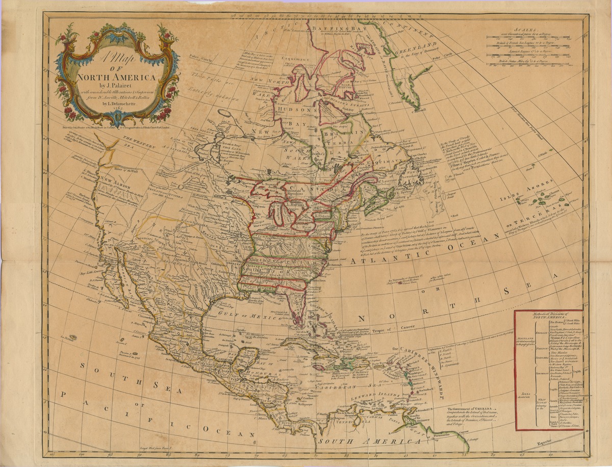
| Title | A Map of North America by J. Palairet, with considerable alterations & improvements from D'Anville, Mitchell & Bellin by L. Delarochette. 1765. |
|---|---|
| Author | Unknown author |
| Date | 1765 |
| Description | All southern colonies stretch west to the Mississippi. Northeast portioned off. "First meridian through Ferro Island." Northwest is unknown. Gulf of Mexico and the Caribbean are well-known. Azores show at far right. Text gives fishing rights of the French people off the northeast coast. |
| Link | https://repository.tcu.edu/handle/116099117/11546 |
| Subject | North America |
